News Flash
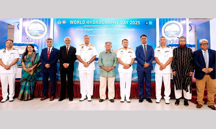
DHAKA, June 21, 2025 (BSS) - The Bangladesh Navy and Bangladesh Inland Water Transport Authority
(BIWTA) today observed World Hydrography Day-2025 through various programmes.
A seminar was organized at the Military Museum Multipurpose Hall in the capital marking the day, said
an Inter-Services Public Relations (ISPR) release.
Shipping Adviser Brigadier General (R.) Dr. M Sakhawat Hussain joined the event as the chief guest
while Chief of Naval Staff Admiral M Nazmul Hassan was present as the special guest.
Members of marine research and organizations concerned, senior government officials, experts in
hydrography and oceanography and research personnel participated in the seminar.
The theme of this year's World Hydrography Day 2025 is “Seabed Mapping: Enabling Ocean Action,”
which highlights the significant role of hydrography in ensuring a prosperous marine management.
Hydrographic data serves as a key driving force for the safe movement of domestic and foreign ships
at sea, sustainable collection and effective use of marine resources.
Papers were presented on various topics including planning for ocean management and blue
economy, seabed change, off-shore aquaculture and fish productivity, enhancement of marine
genetic resources, and seabed mapping as the basis for an integrated ocean monitoring system.
Various issues were discussed to achieve the goal of safe, sustainable and effective utilization of
marine resources through the practical use of hydrographic data.
A special exhibition on hydrographic activities was organized with the participation of various maritime
organizations.
In 2001, Bangladesh became the 70th member of the International Hydrographic Organization.
As the national representative of the International Hydrographic Organization, Bangladesh Navy has
been responsible for conducting hydrographic surveys in the sea and river channels adjacent to sea
ports and publishing international standard nautical charts since 1983.
In addition to printing on paper, all these charts are also being published electronically, which is
essential for the safe navigation of ships of various domestic and international organizations in the Bay
of Bengal.
Hydrographic data plays a very effective role in marine environment protection and management,
fisheries and mineral resource extraction, tsunami, coastal land management, maritime boundary
determination and oceanographic research.
All these data will be helpful for preparing Marine Special Data Infrastructure in the near future.
Through the exchange of innovative technologies and practical experiences related to hydrography,
Bangladesh and other member states will be able to promote the maritime region to a safer, healthier
and more productive role.