News Flash
By Md Mamun Islam
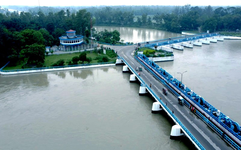
RANGPUR, July 13, 2026 (BSS) – The Teesta crossed its danger level by 3cm again at Dalia point in Nilphamari at 6 pm today, with a possibility of temporary flooding in adjoining floodplains and low-lying areas amid heavy monsoon rains in the last 24 hours.
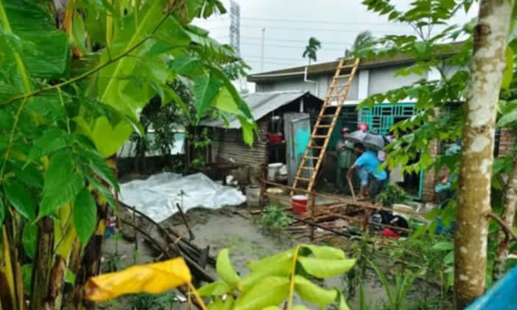
Meanwhile, incidents of sporadic erosion of riverside areas were reported from few places alongside the Teesta, Dharla, Brahmaputra and other rivers in Rangpur, Lalmonirhat, Nilphamari, Kurigram and Gaibandha districts during the last few days.
Bangladesh Water Development Board (BWDB) officials said that during the last 24 hours, the water level of the Teesta in the Rangpur region has increased, while the Dharla and Dudhkumar rivers remained stable.
During the next 24 to 48 hours, water levels of the Teesta and Dudhkumar in Nilphamari, Lalmonirhat, Rangpur and Kurigram districts may rise and exceed their respective danger levels at some locations, causing short-term flooding in adjacent low-lying areas.
In addition, during this period, the Teesta in Gaibandha district and the Dharla in Kurigram district may flow at the Warning Level, and adjacent low-lying areas may be temporarily inundated.
"Following a sharp rise in the water level by 8cm in the last three hours since 3pm, the Teesta was flowing above its danger level by 3cm at 6 pm at Dalia point,” Executive Engineer of the BWDB's Teesta Barrage Division Amitav Chowdhury told BSS at 7 pm.
Earlier, the river was flowing below its danger level by 5cm at Dalia point near the Teesta Barrage Project (TBP) in Dimla upazila of Nilphamari district at 3 pm today.
As the water level is continuing to rise harshly due to heavy onrush of water from upstream, the Teesta may inundate the low-lying floodplains and char areas temporarily in the next 24 to 48 hours.
On the other hand, the Teesta was flowing below the danger level by 42cm cm at Kawnia point in Rangpur, 47cm at Tarapur point and 107cm at Haripur point in Gaibandha district at 3 pm today.
BWDB’s Rangpur Circle Superintending Engineer Md Ahsan Habib told BSS this evening that a temporary flood situation may be created in the low-lying char areas of the greater Rangpur districts in the next couple of days.
"However, there is no possibility of any major flooding in the coming days in the greater Rangpur region of the Brahmaputra basin," he said.
Meanwhile, the Flood Forecasting and Warning Center (FFWC) of BWDB in a bulletin today said heavy to very heavy rainfall is forecast over the Sylhet, Mymensingh and Rangpur divisions and the adjoining Indian states of Assam, Meghalaya and West Bengal during the next 24 hours.
The recorded rainfalls in the upstream Indian states during the last 24 hours till 9am today were 115mm at Mawkyrwat, 111mm at Mawsynram, 108mm at RKM Sohra, 97mm at Kalimpong, 93mm at Coochbehar, 80mm at Shella, 80mm at Williamnagar, 79mm at Cherrapunji and 66mm at Darjeeling points.
During the same period, 209mm at Jamalpur, 165mm at Bogura, 111mm at Kawnia, 62mm at Dalia, 105mm at Dewanganj, 96mm at Gaibandha, 75mm at Chilmari and 61mm at Rangpur points, the FFWC bulletin added.
The Dudhkumar was flowing below the danger level by 97cm at Pateshwari, Dharla by 149cm below its danger level at Kurigram and Brahmaputra was flowing below its danger level by 185cm at Noonkhawa, 153cm at Hatia and 135cm at Chilmari points respectively at 3 pm today.
The Jamuna was flowing below its danger level by 154cm at Fulchhari, 152cm at Bahadurabad, 181cm at Shaghata, 155cm at Sariakandi, 198cm at Kazipur and 160cm at Sirajganj points at 3 pm today.